RWY For Android
The Droid you've been looking for!
RWY takes the intuitive design of OzRunways EFB and brings it to Android in a way that feels familiar but also feels truly Android. RWY turns your Android phone or tablet into an Electronic Flight Bag with everything you need to safely plan, brief and navigate flights.

What's New in RWY
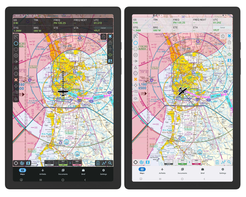
We welcome our most intuitive and easy-to-navigate RWY map screen!
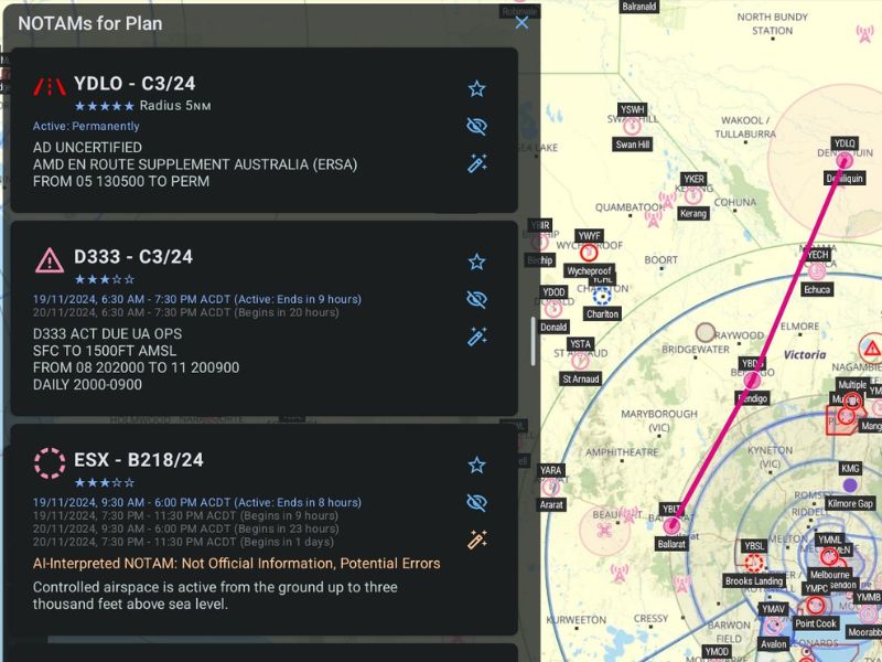
NOTAM Category Filtering
Using the buttons on the right of SmartBrief, you can filter out the NOTAM categories that do not affect you, or hide individual ones completely.
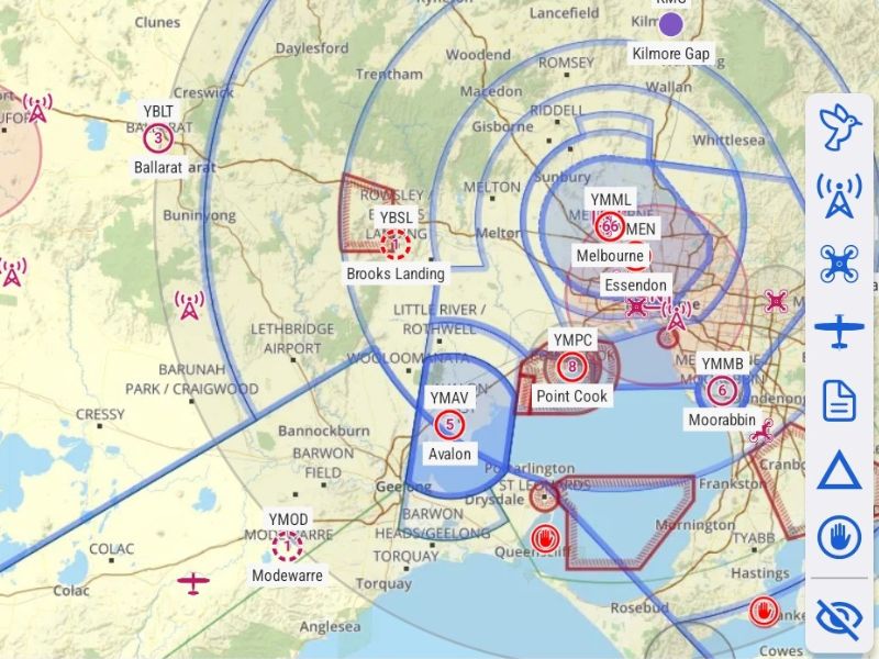
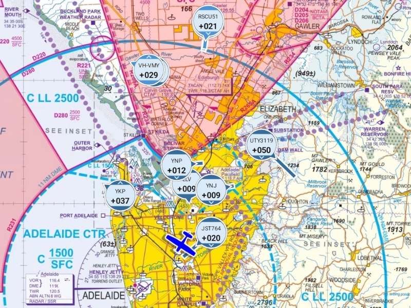
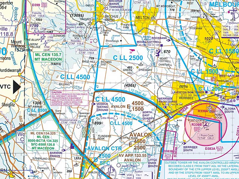
Visual NOTAMs
We extract geolocation data for every NOTAM in Australia and New Zealand. Now you can visualise, filter, and easily read NOTAMs and airspace.

Plain-English Translation
Using AI text decoding, NOTAMs with unfamiliar acronyms can be translated into human-readable summaries.
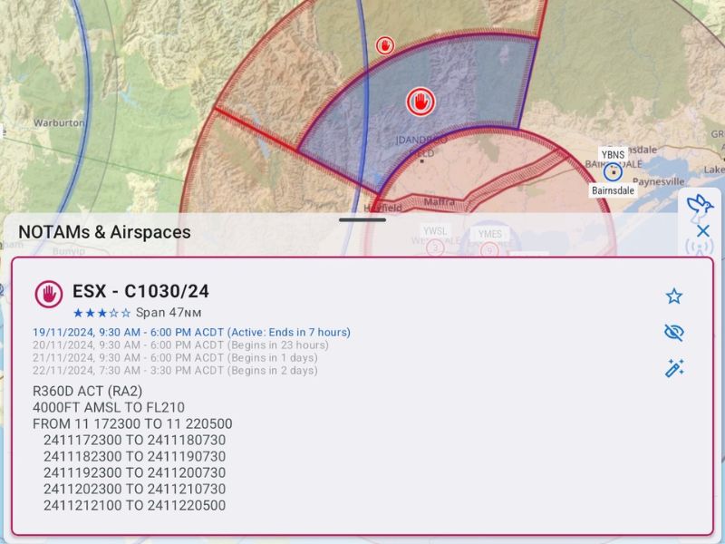
Dynamic Activation Times
Airspace activation times are now more detailed, including amendments by NOTAM. Use the SmartBrief time slider to see whether your flight is impacted. Human-readable activation times make them easier to read.
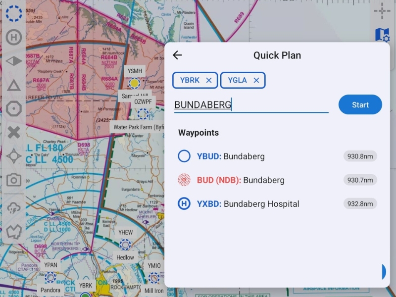
Quick Plan
You can now create a flight plan by typing a successive list of waypoint names or codes, with a suggestion list available as you type. Once all desired waypoints have been entered press ‘Start’ to construct the plan.
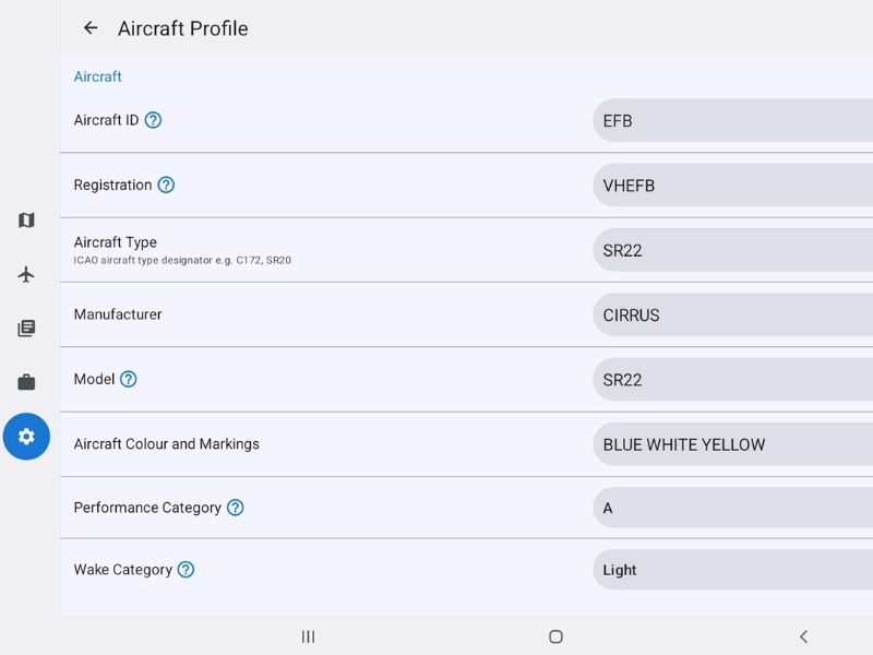
Aircraft Profiles
RWY’s highly anticipated feature makes the jump between aircraft both swifter and more precise. Simply enter the values from the aircraft’s POH once, and these details will be automatically populated every time you create a new flight plan for that aircraft.
OzRunways eAWIS
An exclusive feature for RWY and OzRunways subscribers! eAWIS uses the one-minute observation data from the Bureau of Meteorology, available at locations with an Aerodrome Weather Station. eAWIS is created from unverified one-minute observation data from BoM. For situational awareness only.
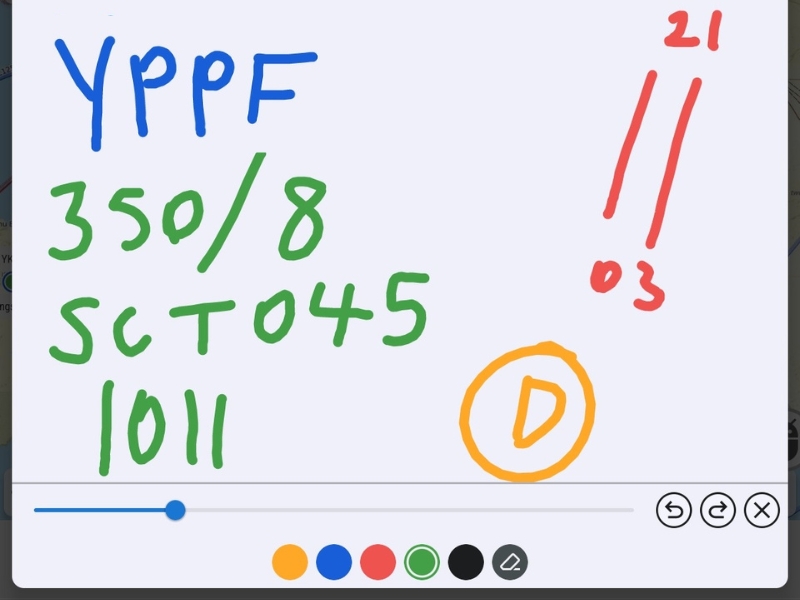
ScratchPad
Access ScratchPad by tapping the pen icon next to 'Choose Map'. ScratchPad is your digital notepad, use your finger as a pen to take down notes, ATIS, traffic etc. ScratchPads can be printed and/or shared.
ADS-B Integration
Low cost, portable ADS-B IN/OUT devices allow all pilots to enjoy the benefits of increased situational awareness, by allowing other aircraft to appear on EFBs as traffic bubbles. Every RWY subscription includes the ability to integrate with GDL90 compatible ADS-B receivers and connecting is easy from inside RWY.
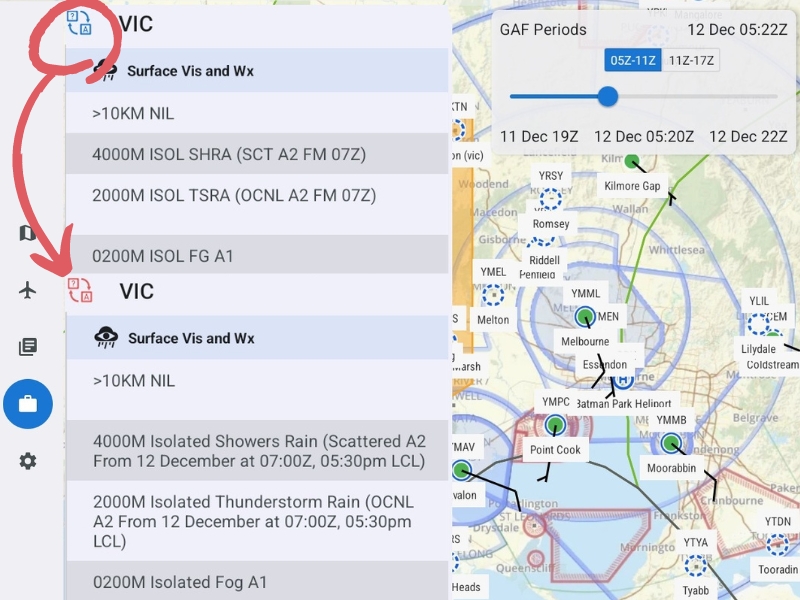
Plain Text in SmartBrief
Don't waste time trying the decode unfamiliar forecast acronyms. The SmartBrief Plain Text Translator converts Area Forecasts to a human-readable version. Look for the translate icon (? --> A) to see this feature in action.
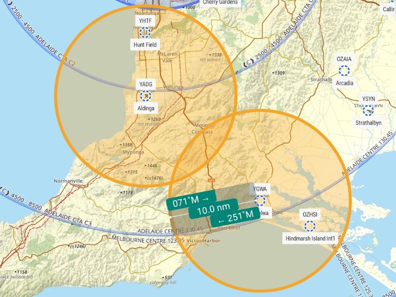
Waypoint Range Rings
Add a custom range ring to any waypoint. Use to display an area of high traffic, a 10nm inbound call point, planned glide distances, or even a great scenic area! Set the distance and colour from our rainbow of options.
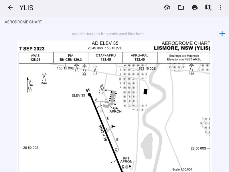
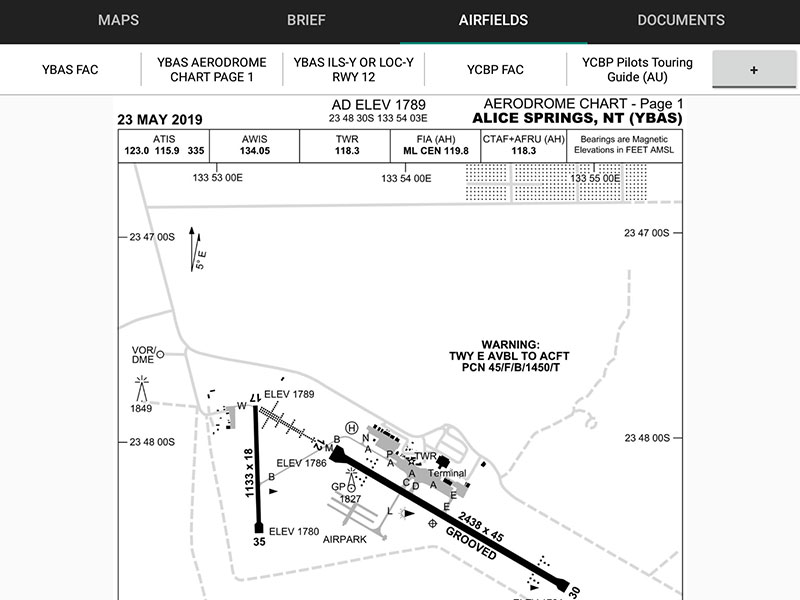
Airport Diagram Double Tap
We've created a shortcut from the map so you can quickly pull up an airport diagram. Turn this feature on in Preferences, to enable a shortcut straight to an airport diagram when double tapping on the location waypoint.
As well as dozens of other minor changes, improvements and bug fixes.
Get Started
Download RWY by OzRunways from Google Play for a 30 day free trial
Plan
RWY has everything you need to create and file IFR and VFR plans.
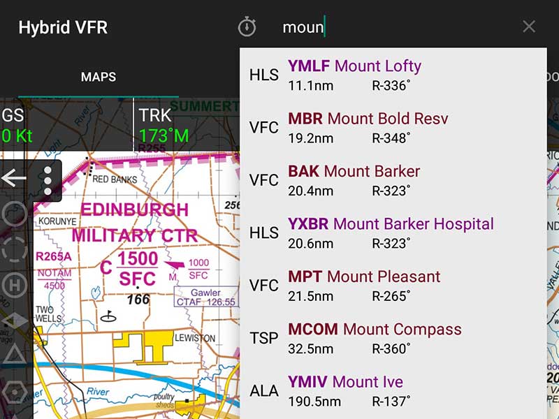
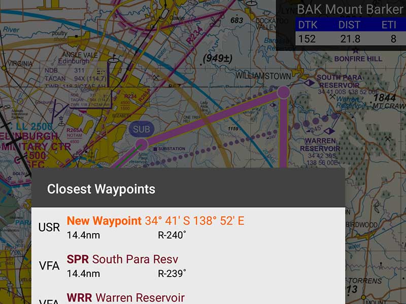
Search Waypoints
Search for waypoints by name or code and add them to your plan, or just go direct to.
Drag and Drop
Add waypoints by rubber-banding. Pickup and drag your track to the place you want to fly over.
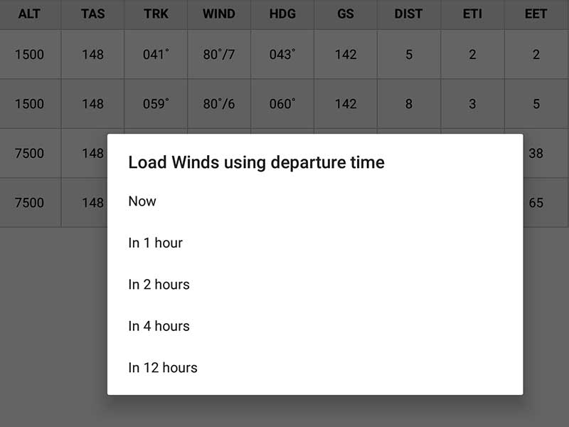
Winds Aloft
At the touch of the screen, load GPWT wind data for accurate heading, time and fuel burn.
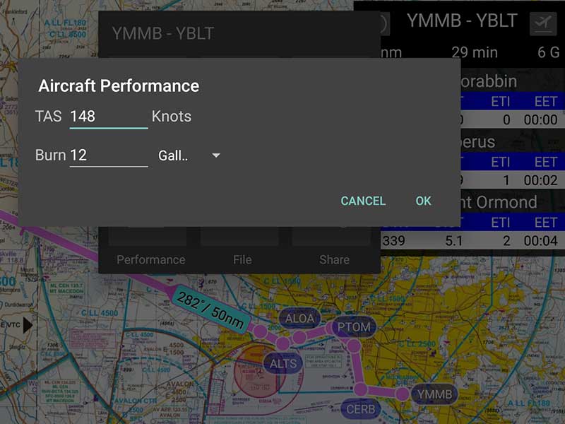
Fuel Burn
Set your aeroplane's fuel burn and TAS for a a reliable calculation of flight fuel required.
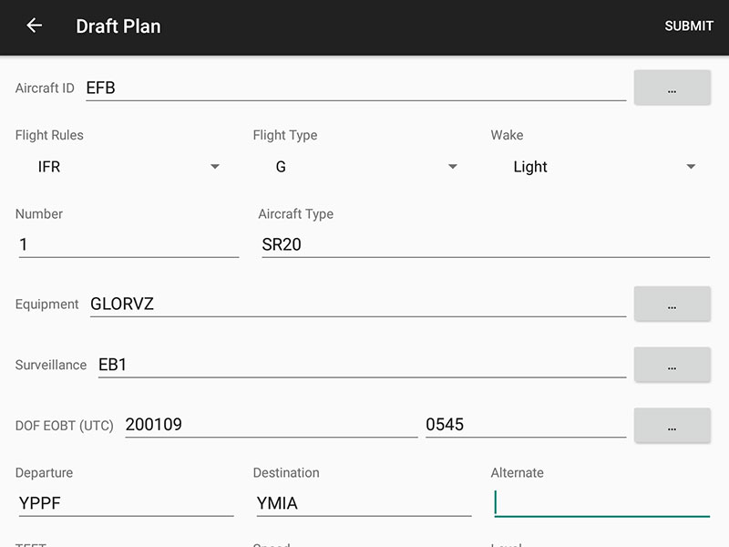
NAIPS Included
With integrated NAIPS flight plan filing that remember your aeroplane's details, filing a plan is easy.
Brief
Quick access to weather and NOTAM information
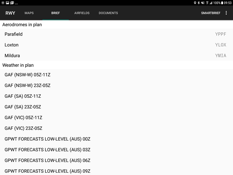
Plan Briefing
Quick access to met and NOTAM for any airports in your plan, plus all the GAF & GPWT on your route.
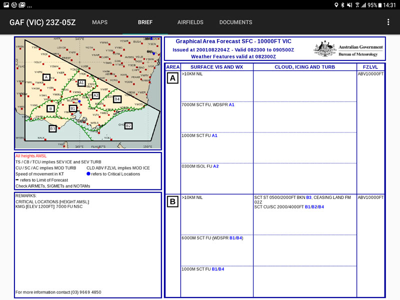
GAF & GPWT
Easy access to GAF and GPWT provide the full weather picture for your flight.
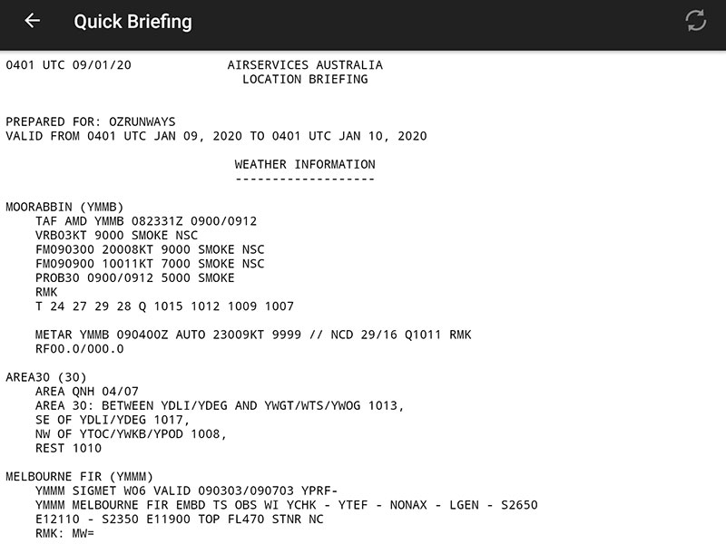
Quick Briefing
Select an airport to view its TAF, METAR and NOTAM information as well as area NOTAMs.
Fly
Fly your plan while the big and bright official aviation maps on your tablet provide the ultimate in situational awareness.
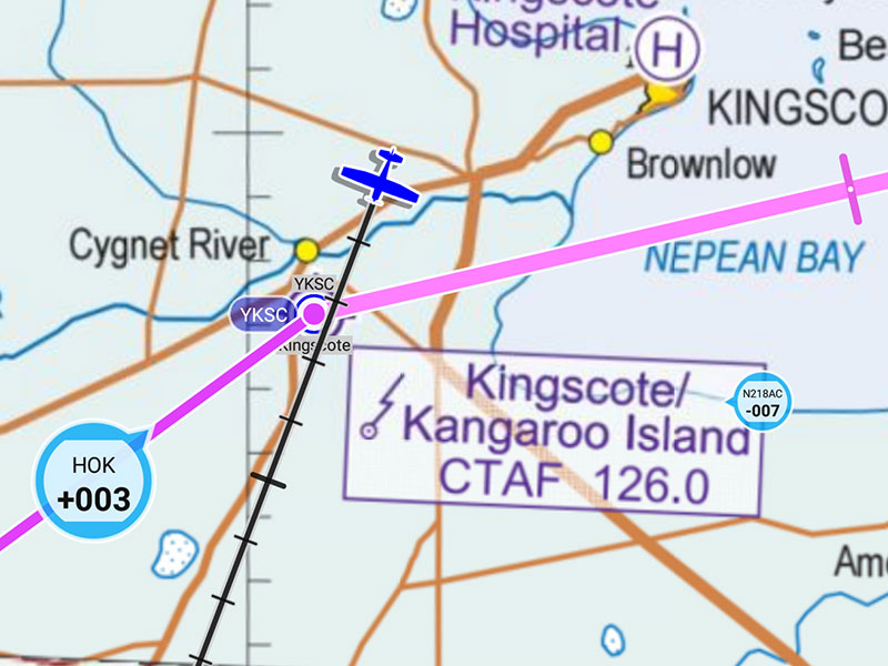
Hybrid VFR Map
The OzRunways Hybrid VFR Map provides a single Australia-wide VFR map, zooming from the WAC to VNC, VTC and even insets so you never have to worry about selecting the appropriate map.
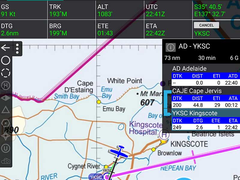
GPS Navigation
Expensive portable aviation GPS units are a thing of the past. See your current position on real aviation maps and get precise track guidance, distance and ETAs.
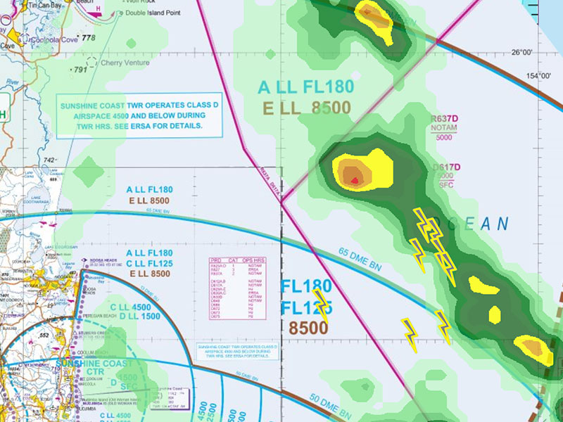
Rain and Lightning
Using high resolution BoM radar and satellite sources, have a near-live view of where not to fly.
Live traffic
See other OzRunways pilots and be tracked wherever you fly for peace of mind of those at home, and to assist in SAR.
ERSA & DAPS
Instant access to always-current ERSA & DAPS wherever you are. Quick access presets make it easy to have the right pages ready to go.
Get Started
Download RWY by OzRunways from Google Play for a 30 day free trial